I hadn’t expected a mysterious monolith in the Utah desert, let alone one that reminded me of the beginning of 2001: A Space Odyssey…
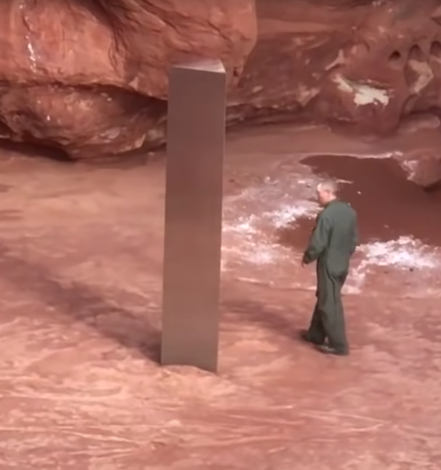 |
| P/C Utah Dept. Public Safety video frame |
… but then again, the Utah Department of Public Safety helicopter crew didn’t expect to see it in a small canyon deep in the Utah redrock desert. (Watch the video at the start of the KSL TV report. The helicopter crew’s cell phone video gives a good sense of how big it is and the canyon setting.)
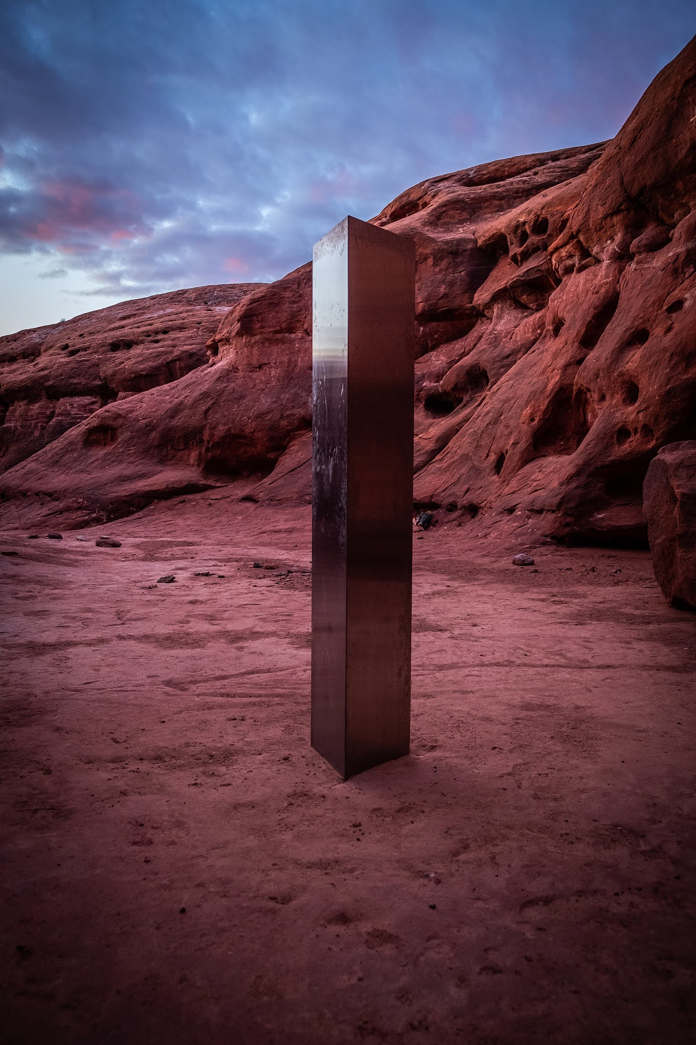 |
| P/C Wikimedia. Photographer: Patrick A. Mackie |
Of course, like all good modern mysteries, the collective intelligence of the internet jumped onboard and quickly figured out exactly where the monolith was located.
In this case, the sleuthing was done by a Redditor who wrote in his post exactly how he found it. Quoting from his post:
I looked at rock type (Sandstone), color (red and white – no black streaks like found on higher cliffs in Utah), shape (more rounded indicating a more exposed area and erosion), the texture of the canyon floor (flat rock vs sloped indicating higher up in a watershed with infrequent water), and the larger cliff/mesa in the upper background of one of the photos. I took all that and lined it up with the flight time and flight path of the helicopter – earlier in the morning taking off from Monticello, UT and flying almost directly north before going off radar (usually indicating it dropped below radar scan altitude. From there, I know I am looking for a south/east facing canyon with rounded red/white rock, most likely close to the base of a larger cliff/mesa, most likely closer to the top of a watershed, and with a suitable flat area for an AS350 helicopter to land. Took about 30 minutes of random checks around the Green River/Colorado River junction before finding similar terrain. From there it took another 15 minutes to find the exact canyon. Yes… I’m a freak.
Let’s dissect this a bit and think about what the Redditor did in SRS terms.
1. They pulled information from the original news story and then found details that would help zero in on the location.
Example: The helicopter crew was from the Utah Department of Public Safety. But what kind of helicopter were they flying? It’s clear from the video there were at least 3 passengers aboard, but how big was the copter? As the Redditor says, they needed a “suitable flat area to land an AS350.”
How do you get to that information? A query like:
[ Utah State Department of Public Safety helicopters]
gets you to their Mission Statement, which includes a list of all the aircraft flown by Aero Bureau. Turns out they only have AS350 Eurocopters, which are 10.93 m (35 ft 10 in) long. That’s not a tiny helicopter, so they’d need a flat circular area at least 20 m (60 feet) in diameter to land.
2. They used publicly available information to determine the flight path. As SRSers know, it’s pretty easy to find flight path information from any of a number of GPS flight information services (e.g., FlightAware and Flightradar24).
3. They inferred clues from the flight information. Noticing that the helio went off radar by dropping below radar altitude is a big hint. That dramatically reduces the amount of area you have to visually search.
4. They just looked around! As we saw in the “Find this coastline” SRS Challenge, sometimes it’s useful just to get into Google Maps or Google Earth and start looking. From looking at the video, the searcher knew they were looking for “… a south/east facing canyon with rounded red/white rock, most likely close to the base of a larger cliff/mesa..” We learned from our earlier Challenge that if you’ve limited the search to a reasonable area, a quick visual scan can be effective.
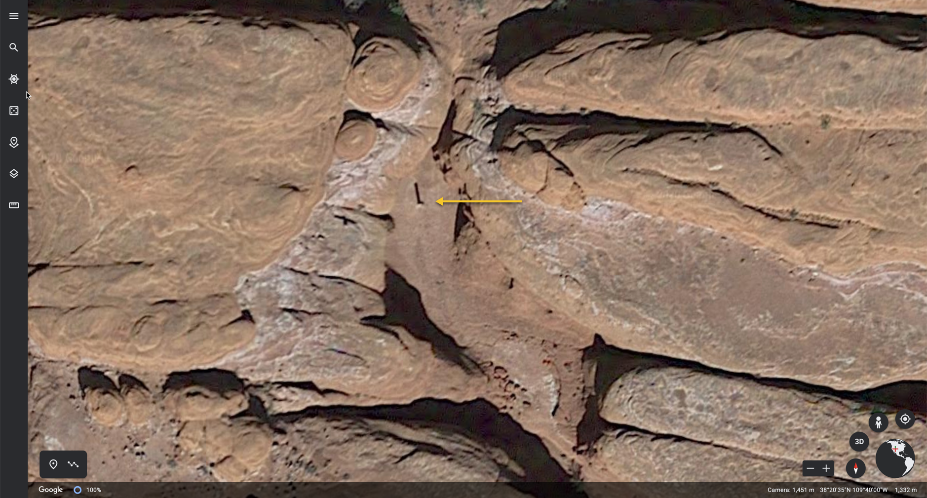 |
| P/C Google Earth. |
As you can see at the tip of the yellow arrow, the Redditor got lucky in that the sun angle just happened to be perfect for casting a long, easily visible shadow. If this were shot at high noon, not much shadow would be seen.
Big SRS Lesson: The subReddit GeoGuesser is a valuable resource to know. A bit of background: People continuously post links to their GeoGuesser Challenges “where is THIS?” questions. Then other GeoGuesser Redditors jump in with ideas and comments as they play. You can learn a good deal about photo interpretation this way, as well as what kinds of clues one can use when searching for an unknown location somewhere on our planet.
There are other subReddits worth knowing (WhatBugIsThis, WhatsThisPlant, or WhatsThisThing). YMMV, but these are often great places to learn search skills in these specific domains.
Then, just as mysteriously as it appeared, the monolith was removed over Thanksgiving weekend. The various Utah and Federal government agencies deny having anything to do with it, so we’re left with more mysteries.
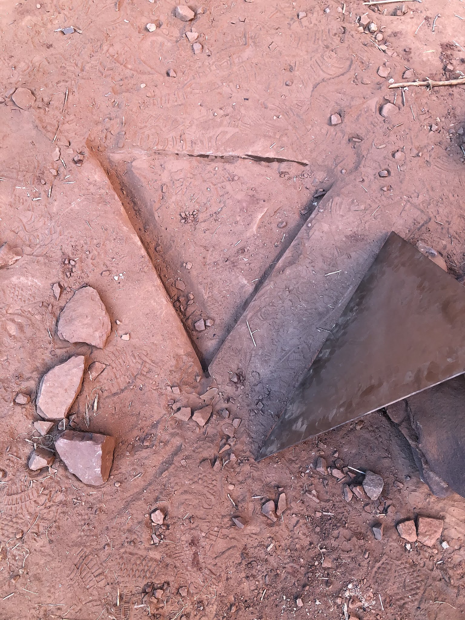 |
| P/C Bureau of Land Management |
Next Challenges for interested folks… Who made and installed the monolith? Then, who removed it? Where did it go? Will it reappear somewhere else on Earth?
I’m not going to spend any time on these mysteries, but if you happen to find out anything, let us know!
Search on!
P.S. If you need a reminder, here’s the link to the YouTube clip from 2001 where the proto-humans encounter the mysterious black monolith.


