As I was flying to Seattle…
... I had the window seat that faced east as we flew north.
Not long after we left SFO, I was staring out the window (because looking out an airplane window when you fly over wilderness is just the best thing you can do), and I saw the most remarkable thing.
It looked like some giant hand had drawn all of the contour lines on the hills below.
What???
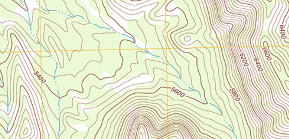
As you know, contour lines on a topographic map mark a constant elevation. For instance, here’s a sample of a topo map with contour lines at 5400 feet, 5600 feet, etc. As you can see, there’s a steep cliff on the right side of the map, with a more relaxed flat spot on the left.
 |
| Sample topographic map with contour lines. |
But the idea of “contour lines” is an artificial way of looking at the land. They’re imaginary lines that are drawn to give the reader an idea about what’s going on with landform.
So you can imagine my surprise when I looked out my window and saw this, with what looks like contour lines in reality…
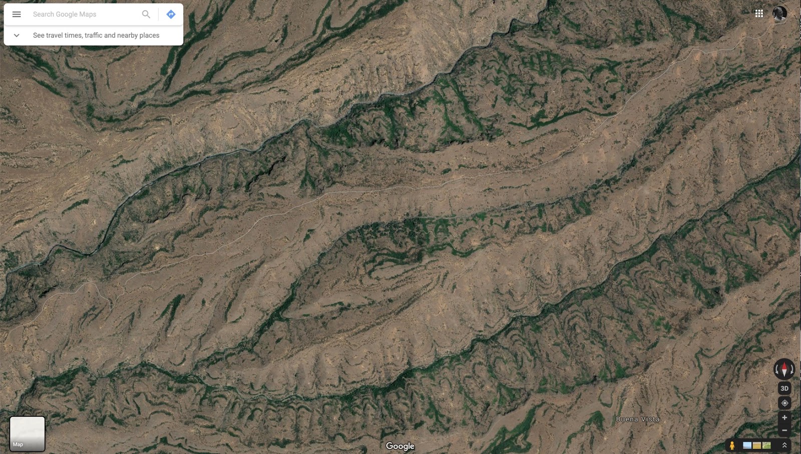 |
| Alas, I didn’t have my camera handy. This is an image from Google Maps of the place I saw out the window. It really does look like this! |
When I got home to my laptop, I searched along the flight path and found the location. (See above.)
Interestingly, if you look at the Terrain view of this location, you’ll see something remarkable:
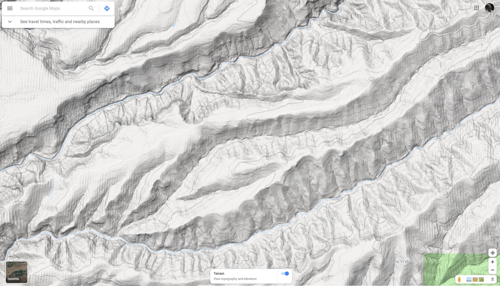
If you put these side-by-side, they’re amazingly similar.
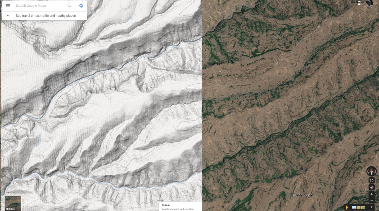
The “contour lines” in the satellite photo are clearly lines of trees or bushes or something growing. This amazes me. I thought contour lines were an artificial construct, a visualization device mapmakers would draw on a map to give a sense of shape on an otherwise 2D image.
But how is this possible? Did some maniac cartographer go out there and plant bushes along the contour lines?
This leads to our SearchResearch Challenge for the week:
1. What is going on with those naturally green “contour lines” that seem to show up naturally? Why are they growing along the lines of constant elevation? What is going on?
Any ideas?
In truth, I have no idea what’s going on here, and what’s more, I don’t have a great idea about how to find out! We’ll figure this one out together.
One useful piece of information: The center of this map is at 40.081801, -121.903088 (link to Google Maps at this location)
When you figure it out, let us know the answer… AND tell us how you did it. We learn from each other, so also be sure to tell us the paths you pursued that didn’t work out.
Search on!


