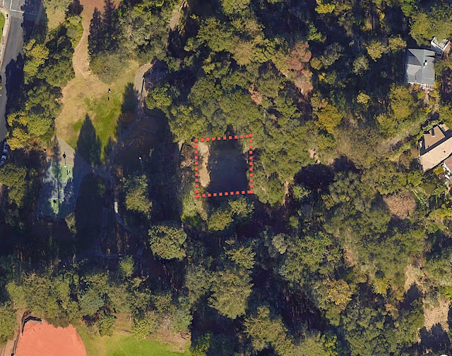
Blank spaces on maps intrigue me,
 |
| What was once here? |
.. as do blank spaces on the land. More than a few SRS Challenges have centered on attempting to find out what happened here–this week’s is in that category–what happened here?
In this case, I was walking through a local park and happened upon an area (see the image above) at 37.885832, -122.261408 that was fairly blank. Since it was on an otherwise hilly area, it looked very much as if a building had been there at one time. There were a few pieces of flat concrete that looked suspiciously like former building foundations, and even more mysteriously, there’s a flagpole on the western edge of the flat spot.
Well… huh. What’s up? After a bit of SRS I found the answer AND another interesting story about the place. This leads to today’s Challenges:
1. What was once at 37.885832, -122.261408? Can you figure out the story given just that lat/long and a keen desire to figure out the past? Was there a building there? If so, who built it and why?
2. The architect that that building is also the architect of a few other pieces nearby. Can you figure one that’s closest to this spot?
As I mentioned last time, I’m deep in the middle of running my class at Stanford, so I’m going to keep the SRS Challenges on the interesting/fun but not-difficult side for the next 2 months. Hope you enjoy these just as much!
Search on!


