There’s much to learn here…
… and since the previous post was growing so long, I separated out the SRS Lessons Learned section for today. Let’s dive right in…
SearchResearch Lessons Learned
This Challenge–trying to explain a counterfactual (why the southern Carquinez Strait is relatively undeveloped)–is difficult. This usually true for this kind of research question (WHY didn’t something happen is just plain hard)!
But I had a great time wandering through news archives, old maps, and anything I could find that might tell me a bit of the history of this region. This was particularly difficult to do because there’s not a great place name that you can use to search for information about the area. That’s why…
1. Names, especially place names, are incredibly valuable. At the beginning of my search I looked at several different current maps to find names of places that we could use in our searches. Place names for villages, parkland, ranches, nearby cities, rivers, and mountains–that’s all useful for searching. The most important find for me was learning that this entire region was once called Rancho Cañada del Hambre y Las Bolsas. That turned out to be key for later historical research.
2. Take notes as you go. I can’t emphasize this enough. When you start an SRS research project, take notes. I find myself constantly referring back to them as I go along. Take special care to note names, places, events… and most importantly… where you found those bit of data. Often 90% of your notes will go unused–THAT’S OKAY! You’ll really need it for that critical 10% that you can’t quite remember and need to get right.
3. Don’t forget archival newspapers. Of course. We’ve covered this before, but it bears repeating. (See my earlier SRS post about this: Online News Archives and another one for some tips about how to do this.) The simplest way is to search for: [ list of newspaper archives ] which will quickly take you to the great Wikipedia list of digitized newspapers that covers the US and many other countries.
From that list I mostly use the Library of Congress Chronicling America site, and the California Digital Newspaper Collection. Both have extensive collections and cover the years 1918/1919. (For backup, of course I’d check the Google News Archive. That archive has a very different set of sources that either Chronicling America or the CDL.)
In addition, I also use the commercial site Newspapers.com, which has a really marvelous search interface (and their display interface is, without question, the best in the business). It costs real money, but some public libraries offer access (through their web portal), and many (nearly all?) university libraries have access to them as well. You should hang onto your college/university library login for as long as they’ll let you keep it.
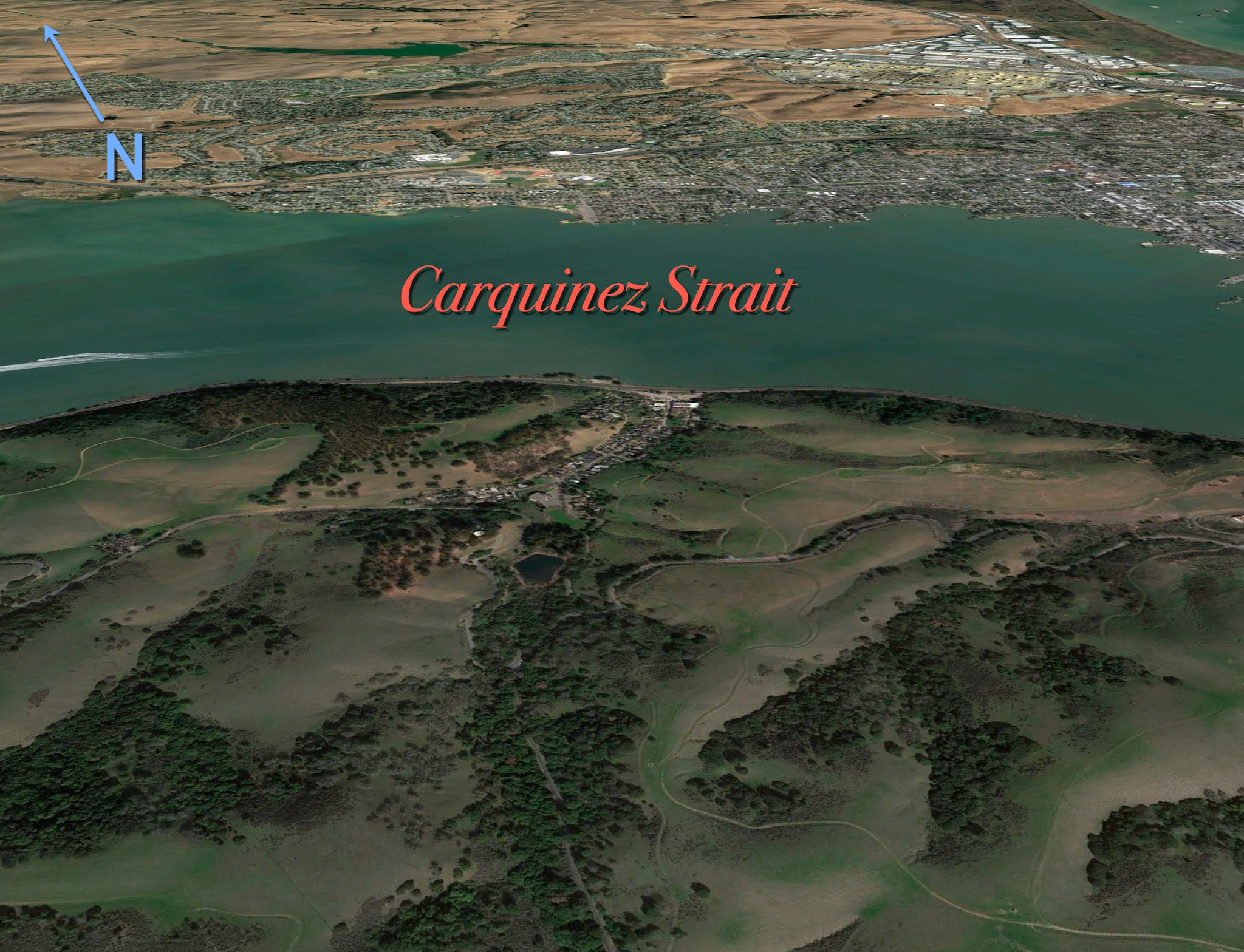
4. Check assumptions by getting a global overview. As you saw, the first few searches I did were to look at archival aerial images for the region (using Google Earth). I was checking to see if there was something about this place that was odd or distinctive. Was it all covered in mines? Was it perhaps all marshland or some kind of endlessly stony fields? I searched for (literally) a birds-eye view to check. (I didn’t find anything, but I might have!)
5. For archival information, Etsy and eBay are more useful than you might imagine. Yeah, who would have guessed. But I can often find archival materials (especially ephemera that’s not captured in any online archive).
6. County assessors have the ground truth on current land ownership. I went into some depth in an earlier post (Looking up Land), but you should remember that in the US, county assessors often have decent GIS systems that let you look up all kinds of (literal) ground truth.
7. Look for (and note) special search terms / phrases that will be useful. In this case, the phrase “land use planning” is a special term of art that’s used to describe what governments decide about a piece of land. Searching with this phrase turned out to be incredibly useful, and revealed much about how that land is currently allocated.
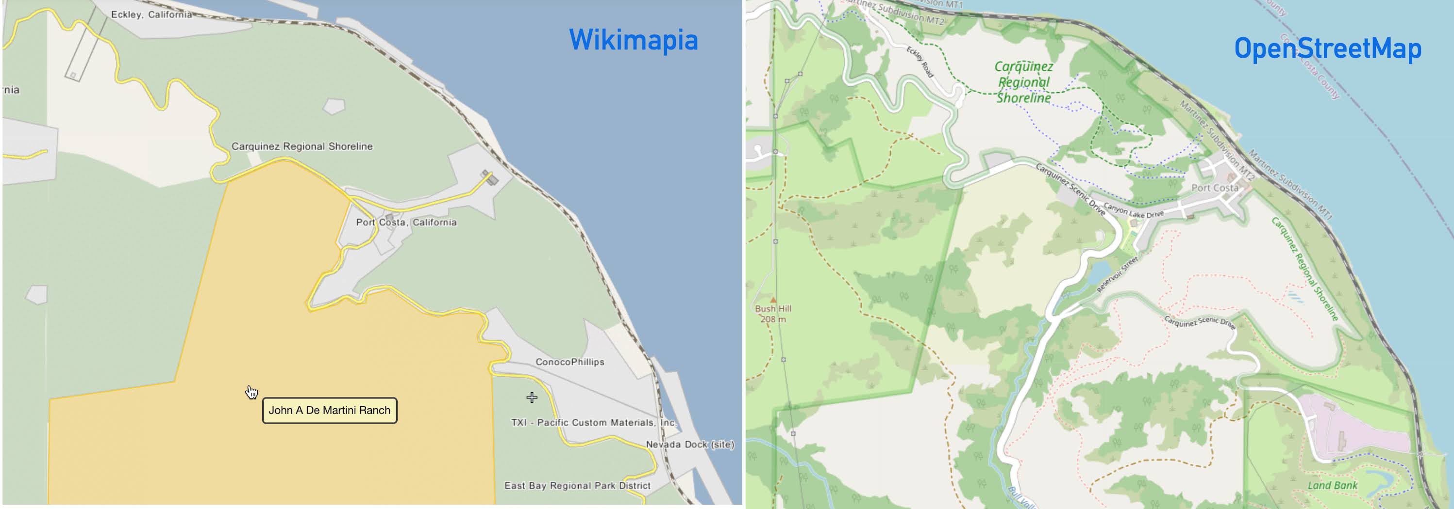
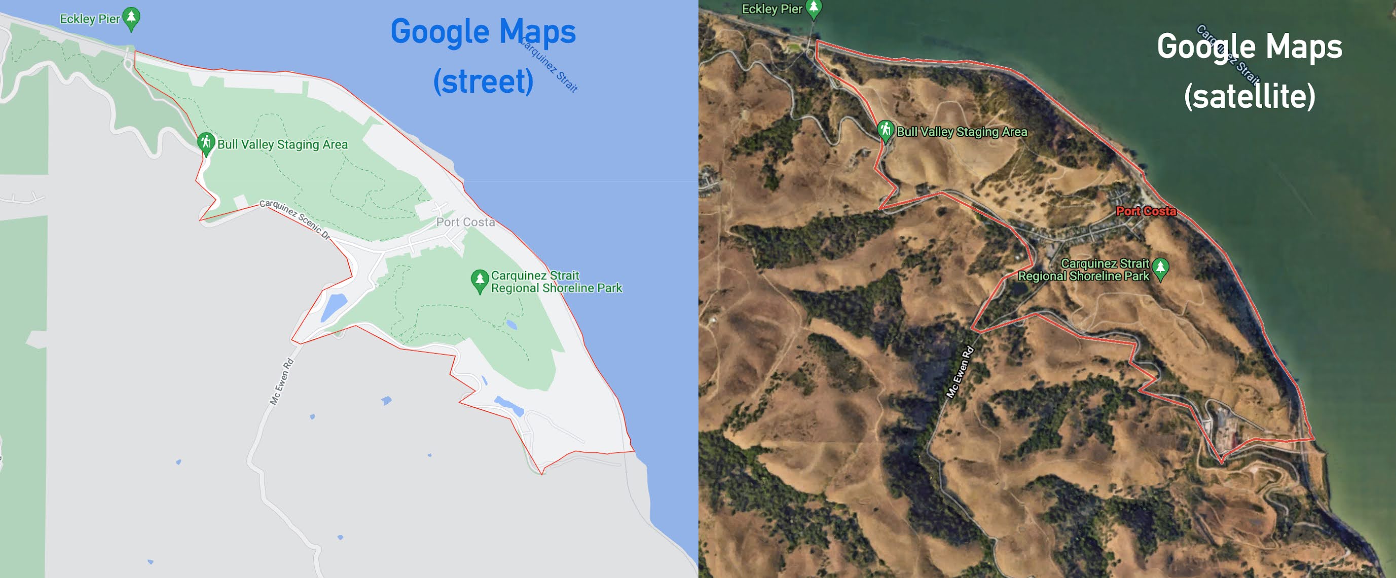
8. Triangulate what you learn. In some ways, the best learning often comes from comparisons. In this SRS we found that comparing the OpenStreetMap view with the Google Maps view AND the Wikimapia view is very telling. Here’s a side-by-side that shows what I mean. Always do these kinds of side-by-sides with your data (which isn’t always in a neat map format). In particular, for OpenStreetMap and Wikimapia, the rollover popups can often hold valuable information. Pay attention!