1. Map resources – maps of all kinds, many interactive
2. Geo-data visualization tools – interactive maps that let you see information of various kinds on a map (or in the form of a distorted / colorized / annotated map).
3. Professional mapping tools and data – there’s a very large number of professional data resources and tools to manipulate them.
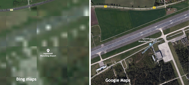
There are also the Microsoft versions of these: Bing Maps, Bing Maps Aerial (like Earth), and Bing Streetside (like Street View).
And there’s more! Note also that Yandex has a map, as does Tencent (the Chinese company) and Baidu (the Chinese search engine). LOTS of general purpose maps out there.
 |
| Not every country agrees that this border is the actual extent of the PRC. (Esp. the part that runs down into the South China Sea.) |
[ Wikipedia ]
and then skipping down to the section called “See Also” (I’ve used this trick to find many other fascinating mapping services).
 |
Jon-The-Unknown pointed out this great Marine Traffic map, here showing the marine traffic near Vancouver:
Search Lessons
There’s a big lesson here for all of us.. and that is that the world of mapping, geo-information, and geographic tools is gigantic. It’s a major project to pull a complete list of resources, and the moment it would be published, it’d be out of date.
So, instead, I want to focus our lessons on strategies for finding the resources we need–be in a data set, a tool, or a mapping visualization system.
As we saw above, there are a couple of quick and easy strategies:
1. Search broadly for the data (or tools or systems). Think about it–this field is changing rapidly–things that were around even a couple of years ago no longer are available, or they’ve been combined with other systems. SO… even if you know of a system, you might have to go looking around for what the system is called now. (Another argument for keeping those search skills sharp!)
2. Look for synonyms or other ways of describing the thing you’re looking for! As you read, take not of other similar systems… and then use those terms to search for MORE resources.
3. Try to locate people, projects, or institutions that work in the area and look at what they’re doing / what they’re interested in. Follow their tweets, look fo their home pages, and read their work. You’ll probably learn something that will lead to new discoveries!
My favorite new mapping application? Using this exploration method, I discovered this interactive map application (DinosaurPictures) that shows the continents at different points over the past few million years. Here’s what our planet looked like this 150M years ago…
And keep searching on.. even over the megayears!


