Date shakes…. yum…..
 |
| Shields Date Farm–with excellent date milkshakes and fascinating educational videos. |
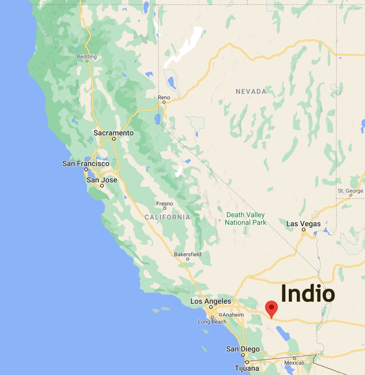
I haven’t been to Indio in probably 20 years, so I was fairly surprised when I happened to look at the Coachella Valley on Google Maps last week. It’s a MUCH different place than I remember from the days when we drove through in search of date-based frozen confections.
It’s useful to know this: the center of US date production is near Indio, in the Coachella Valley. That, plus ice cream, means date shakes.
All of these changes leads us to this week’s Challenge:
What are the largest changes to landuse in the Coachella Valley over the past 40 years? (That is, the valley centered around: 33.711896, -116.210818) What kinds of changes can you spot?
There are many ways to do this piece of SearchResearch, but a GREAT way start such investigations is by getting a visual overview. Google Maps works well to get a look at the place from the maps overview.
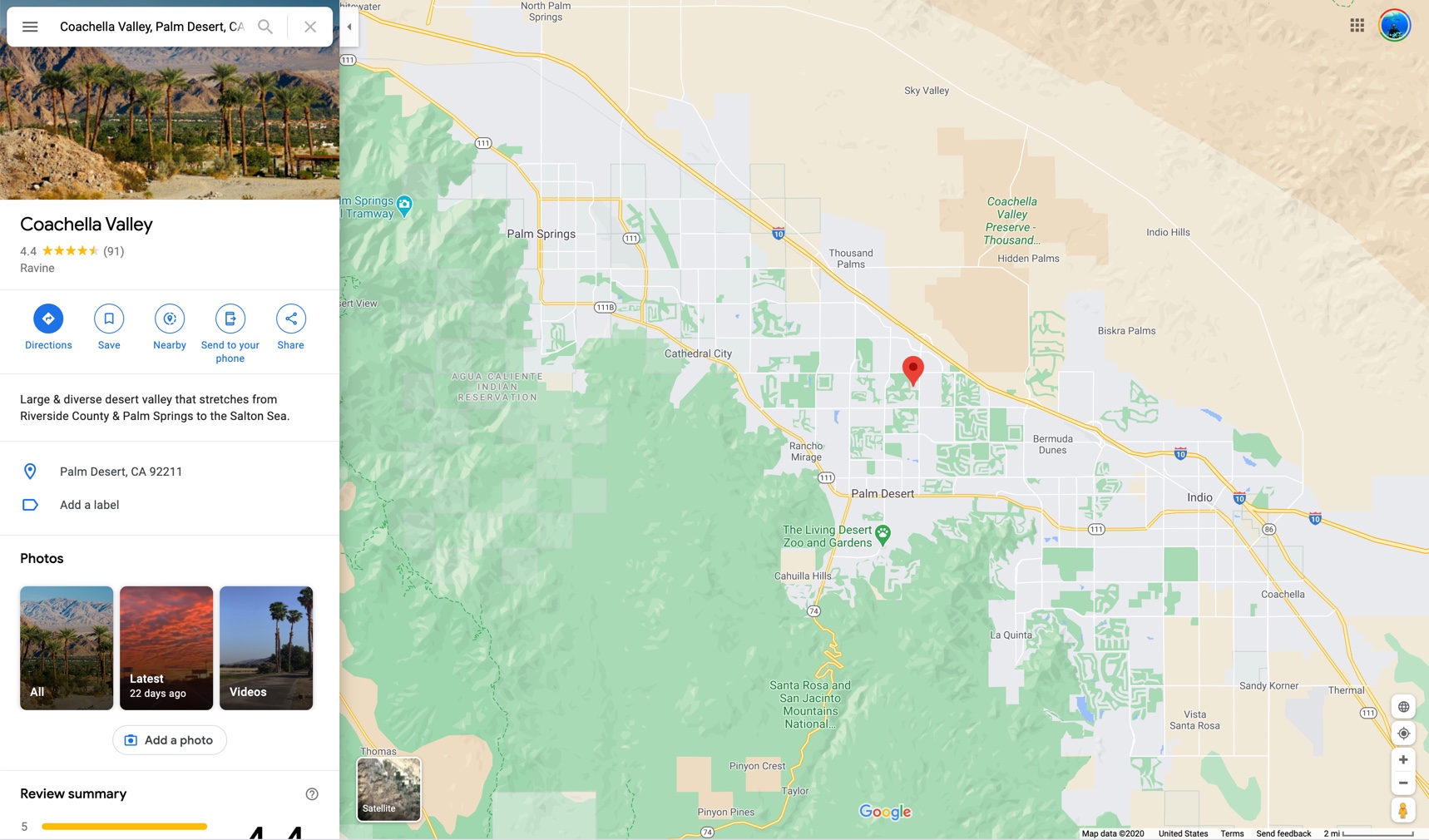
Even at this range, you can get a big clue from all of the green blocks…
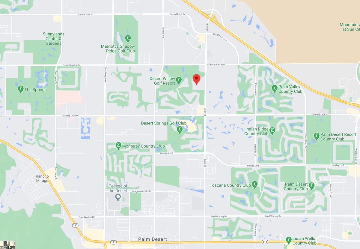
That’s a lot of golf courses! It’s even more interesting in satellite view:
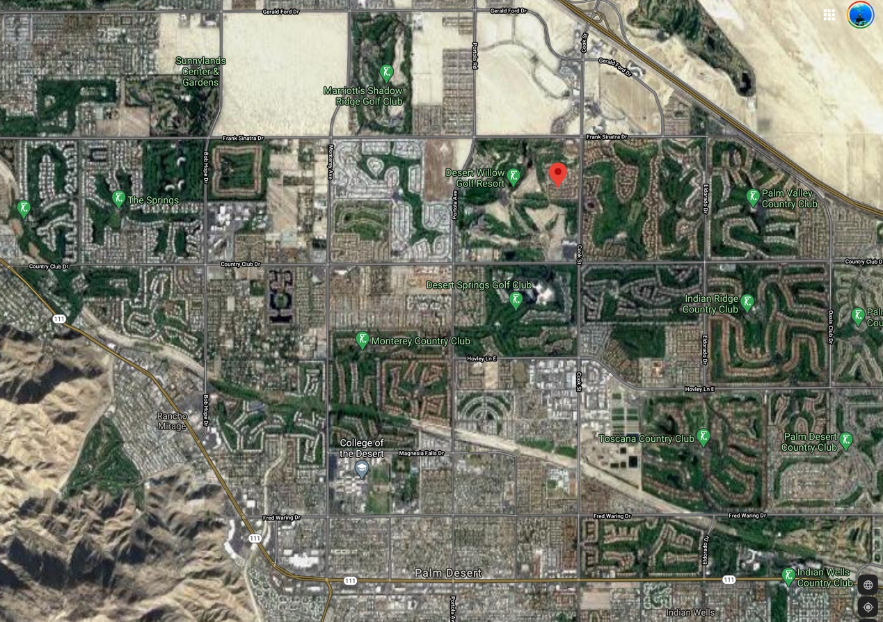
Aside from all of the green here, there’s also a LOT of water in this view.
Of course, Google Earth has archival images (we’ve discussed this before). Here’s a pic from 2002 of the Indio area. Contrast this with the image above from 2020.

But wait–isn’t this a desert? Look at the color of all the ground all around the valley! Note how far away Death Valley is (not far).
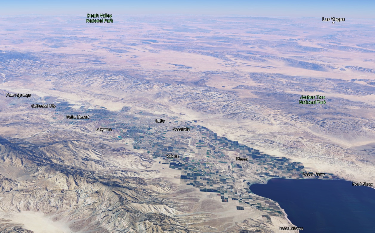
So, sure, the valley is pretty clearly well-watered, but surrounded by desert. (And yes, I know that looks like a giant lake in the bottom right corner–but that’s the Salton Sea. It’s pretty salty–about 60 parts per thousand. By comparison the ocean is about 35 PPT. What’s worse–the salinity of the Sea increases every year since it doesn’t have an outflow, but just slowly evaporates.
From a land-use perspective, how is it possible to support all of those golf courses and lakes in the desert?
While that’s an interesting land-use question, how can we quickly get an overview of 40 years of land uses? That’s a lot of time to cover. What about a timelapse satellite view?
My query:
[ time lapse Earth ]
leads quickly to Google Earth Timelapse. It doesn’t take long to search for Indio and the Coachella Valley. Here’s the YouTube video I made that neatly shows the enormous changes in the valley between 1984 and 2018.
When you watch the video, look at one spot and watch how it changes over time. Mostly, you’ll see the transformation of the valley floor from agricultural to golf courses, hotels, and urban areas.
While this gives a great visual summary of the changes and how profound they are, a fairly straightforward query leads to fairly extensive documentation of the changes. My query:
[ land use change Indio California ]
led to lots of news reports about various land use proposals, maps, studies, and plans. (Example: Indio land use maps, plans, and studies and articles like Land Subsidence in the Coachella Valley that covers land changes in the area over the past 100 years). In reading through these documents, it’s clear that water use is one of the leading factors in growth and land use. A second query:
[ water use history Coachella Valley ]
gives somewhat broader results. (Example: the Coachella Valley Water District’s history since 1918.)
Why are the results broader? Because land use is typically not a city-by-city concern, but more a regional (or county) concern. In the Coachella Valley’s case, changes in water supply in the 1960s allowed the rapid growth of building, leading to Indio and the surrounding area to become a tourism destination. Golfing lead the way when, “in the 1980s, 34 courses opened. That’s about one every 100 days for an entire decade, and we had homes being built around these courses.” Palm Springs Golf: A History of Coachella Valley Legends & Fairways (2015).
So, what about land use?
The bottom line for Indio (and the Coachella Valley) is that it was an old agricultural spot that lasted for many years until a sudden influx of water supply (from the Colorado River) suddenly made growing golf courses, water hazards, and homes a much more lucrative business than dates and table grapes.
Luckily, the general land use plan has reserved significant land for agricultural purposes. But water management issues dominate the place. Land subsidence, resulting from aquifer-system compaction and groundwater-level declines, has been a concern of the Coachella Valley Water District since the mid-1990s, with close monitoring of ground water required to keep things on an even keel.
Over the past 40 years Indio has seen a profound change in the way land is used–what was nearly all agriculture is now about half urban and recreational (especially golf!) uses.
As the nearby Salton Sea reminds as (as it dehydrates into a toxic, dusty ecological disaster), water means everything in this corner of the southwest. If a long drought strikes, or water allocation patterns change (for whatever reason), a place like Indio, and its golf courses, could dry up and revert back to a place of date palms growing in a desert landscape.
SearchResearch Lessons
1. Look for tools. You knew that Google satellite view maps would be useful, and you might even know that Google Earth has a fantastic image archive, but finding the Time Lapse version of Google Earth is a huge asset. Remember to search for a tool to help you with your task.
2. Vary the regional terms you use. There are a few documents about “land use” topics that are connected with Indio, but there area LOT more if you search for land-use in conjunction with a larger regional description (“Coachella Valley”).
Search on!